
Trip Report: Grand Canyon National Park
The big one. The one "must see" national park. For years I postponed this trip, believing the hype that this was something better seen in books or on television. While it is true, your pictures are not going to rival those in a travel brochure, no picture truly captures the immensity of this wonder.
 |
| Arizona Rt-64 North |
Route 64 is the main artery used by canyon tourists coming from Flagstaff and other points South. The road is flat and straight, but definitely not boring. Every thirty or so miles you come upon some civilization, be it gas stations, farms, or other points of interest. Together they help one imagine what taking a vacation in the United States must have been like in the 1950s: Long empty stretches of road with only occasional signs of civilization.
 |
| Fred's Diner, Rt-64, Williams, AZ |
This motif continues up to park's entrance, even the two fast food restaurants don't seem too out of place. The Red Feather Lodge, where I stayed, definitely played to the road trip tune, reminding me of the motels from my childhood roadtrips.
 |
| Red Feather Lodge Postcard |
Tip:When staying at the Grand Canyon, the best rates are always found outside the park. However be sure to take driving distance into consideration. Valle and Williams are about 45 and 70 minutes away, respectively, whereas Tusayan (and the Red Feather Lodge, among others) is only 5 minutes away.
 |
Nothing can prepare you for the scale of the Grand Canyon. Pictures capture its beauty, but fail in capturing its immensity.
 |
Tip: Don't miss the sights on the Hermit's Rest portion of the rim trail. Although most visitors skip this section, I spent the majority of my time here watching Ravens play in the wind rushing up the cliff sides. For views, Trailview and Pima Point were my favorites and Hopi Point is recommended as THE sunset location.
 |
| Paved portion of the Rim Trail on Hermits Rest Route |
At night, the canyon's personality changes. There are no sounds of civilization, no light; it's just you, darkness, and on a clear night, stars. More stars than I have ever seen.
On the rim, you see mile upon mile of blackness, only occasionally interrupted by the small light of a campsite or ranger's vehicle. But all is not silent, you occasionally hear the wind, as it slowly whips around the canyon, until it briefly envelops you.
And then slowly, silently, the sky in the west starts to get definition. Equally as slowly, the first tourists of the day start to arrive to great the sun and another day begins.
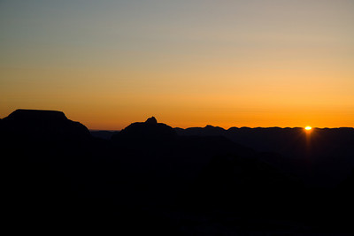 |
| Spring Solstice Sunrise from Mather Point |
 vacation
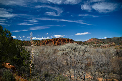

")


